Nestled at the foot of magnificent glacial carved mountains facing the Pacific Ocean on Baranof Island, Sitka is located on the outer coast of Alaska’s Inside Passage and lies at the heart of the largest temperate rain forest in the world, the Tongass National Forest. With views of island-studded waters and forests descending to the water’s edge, Sitka is home to 9,061 people.
Sitka’s colorful past is a unique blend of native Tlingit culture and Russian history. In 1867, when the United States purchased Alaska from the Russians, the transfer ceremony was held in Sitka, and Sitka became Alaska’s first capital city.
Accessible only by air or sea, Sitka offers incredible scenery, fishing, hiking, abundant wildlife, and Alaska’s most culturally rich history and community. There are twenty two buildings and sites in Sitka that appear in the National Register of Historic Places. Residents and visitors alike enjoy and experience all this dynamic town has to offer.
 2008 Destinations rated: In 2008, Sitka was the only town in Alaska chosen to be surveyed for the prestigious destination-stewardship survey for National Geographic Traveler (NGT). We are proud to say that Sitka ranked 48 out of 109. Sitkans think that's pretty good for our small, diverse, historic community. NGT says, "In the end, people make the difference. No surprise there. A homegrown sense of stewardship, along with the support of caring visitors, is what will secure the future of our pasts."
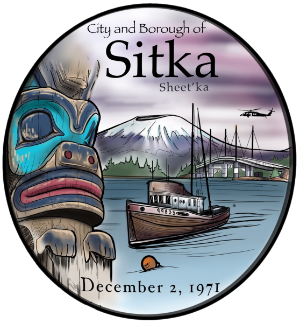
 The City and Borough of Sitka is a unified city-borough located on the west side of Baranof Island in the Alexander Archipelago of the Pacific Ocean (part of the Alaska Panhandle), in the U.S. state of Alaska. Sitka enjoys the distinction of being the only town in Southeast Alaska that faces the Gulf of Alaska. With an estimated population of 8,986 in 2005, Sitka is the state's fourth-largest city by population in Alaska and the largest city by area in the United States, four times the size of Rhode Island. Sitka also boasts the largest harbor system in the State of Alaska.
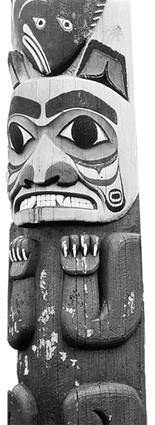
Sitka’s history began as the ice that covered much of Southeast Alaska began to recede. According to a Tlingit legend, Mount Edgecumbe, a 3,200-foot-tall dormant volcano, located on southern Kruzof Island, was the smoking beacon that brought the original native Tlingit Indians to Sitka around 10,000 years ago.
 Old Sitka was founded in 1799 by Alexandr Baranov, the governor of Russian America. Baranov arrived under the auspices of the Russian-American Company, a "semi- official" colonial trading company chartered by the Tsar. Old Sitka was founded in 1799 by Alexander Baranov, the governor of Russian America. Baranov arrived under the auspices of the Russian-American Company, a "semi-official" colonial trading company chartered by Tsar Paul I. In 1802, a group of Tlingit destroyed the original establishment known as Redoubt Saint Michael (an area today called the "Old Sitka") and massacred most of the Russian inhabitants. Baranov was forced to levy 10,000 rubles in ransom for the safe return of the surviving settlers.
Baranov returned to Sitka in 1804 with a large contingent of Russians and Aleuts aboard the Russian warship Neva. The ship bombarded the natives' village, forcing the Tlingits to retreat into the surrounding forest. Following their victory at the Battle of Sitka,the Russians established a permanent settlement in the form of a fort named "Novoarkhangelsk" (or "New Archangel", Photo by William Greer a reference to Arkhangelsk, the largest city in the region where Baranov was born). In 1808, with Baranov still governor, Sitka was designated the capital of Russian America.
Cathedral of St. Michael, the seat of the Bishop of Kamchatka, the Kurile and Aleutian Islands, and Alaska, was built in Sitka in 1848.
 The original church burned to the ground in 1966, but was restored to its original appearance, with the deliberate exception of its clockface, which is black in photographs taken prior to 1966, but white in subsequent photos.
Bishop Innokentii of the Russian Orthodox Church lived in Sitka after 1840. He was known for his interest in education, and his house, parts of which served as a schoolhouse, the Russian Bishop's House has since been restored by the National Park Service. Swedes and Finns were both important parts of the Russian empire, and the Sitka Lutheran Church, built in 1840, was the first Protestant church on the Pacific Coast. After the transition to American control with the transfer of Alaska from Russia to the United States in 1867, influence of other Protestant religions increased, and St. Peter's by-the-Sea Episcopal Church was consecrated as "The Cathedral of Alaska" in 1900.
The town served as the capital of Russian America until 1867, and was the busiest seaport on the west coast of North America, as evidenced by Dana in his popular account of an 1834 sailing voyage, Two Years Before the Mast.
Sitka was the site of the ceremony in which the Russian flag was lowered and the United States flag raised after Alaska was purchased by the United States in 1867 after the sea otter pelt trade died out. The flag lowering and raising event is re-enacted in Sitka every October 18 (Alaska Day). After the original ceremony, the entire U.S. government presence in Alaska until the Klondike Gold Rush consisted of a single customs inspector on the island. Sitka would serve as the capital of the U.S. Department of Alaska (1867–1884) and District of Alaska (1884–1906) until the seat of government was relocated to Juneau in 1906 when Alaska became a territory. The state's first newspaper, The Sitka Times, was published by Barney O. Ragan on September 19, 1868.

While gold mining and fish canning paved the way for the town's initial growth, it wasn't until World War II, when the Navy constructed an air base on Japonski Island, (with its 30,000 service personnel) that Sitka finally came into its own. Today Sitka encompasses portions of Baranof Island and the smaller Japonski Island (across the Sitka Channel from the town), which is connected to Baranof Island by the O'Connell Bridge. O'Connell Bridge was the first cable stayed bridge built in the Western Hemisphere. Japonski Island is home to Sitka Rocky Gutierrez Airport, the Sitka branch campus of the University of Alaska Southeast, the Mt. Edgecumbe High School — a state-run boarding school for rural Alaskans, the Indian Health Service regional hospital SEARHC (Southeast Alaska Regional Healthcare Center), a U.S. Coast Guard air station, and the port and facilities for the USCGC Maple.
According to the United States Census Bureau, the City and Borough of Sitka is the second largest incorporated area in the U.S, with a total area of 4,811.5 square miles (12,461.8 km2). 2,874.0 square miles (7,443.6 km2) of it is land and 1,937.6 square miles (5,018.2 km2) of it, or 40.27%, is water.
Sitka displaced Juneau, Alaska as the largest city upon the 2000 incorporation with 2,874 square miles (7,440 km2) of incorporated area. Juneau is 2,717 square miles (7,040 km2) and was formed through incorporation of the borough and city in 1970.
As of the census of 2010, there were 8,881 people, 3,545 households, and 2,211 families residing in the borough. The population density was 3.1 people per square mile (1.2/km2). There were 4,102 housing units at an average density of 1.3/sq mi (0.5/km2). The racial makeup of the borough was 65.3% White, 0.5% Black or African American, 16.8% Native American, 6.0% Asian, 0.3% Pacific Islander, 1.3% from other races, and 9.8% from two or more races 4.9% of the population were Hispanic or Latino of any race.
There were 3,545 households out of which 29.5% had children under the age of 18 living with them, 45.5% were married couples living together, 10.7% had a female householder with no husband present, and 37.6% were non-families. 29.0% of all households were made up of individuals and 20.8% had someone living alone who was 65 years of age or older. The average household size was 2.43 and the average family size was 3.01. In the borough, the population was spread out with 25.7% under the age of 19, 5.8% from 20 to 24, 27.2% from 25 to 44, 24% from 45 to 64, and 17.2% who were 65 years of age or older. The median age was 38 years. The median income for a household in the borough was $58,895, and the median income for a family was $71,068. The per capita income for the borough was $30,013. About 4.0% of families and 6.7% of the population were below the poverty line, including 6.1% of those under age 18.